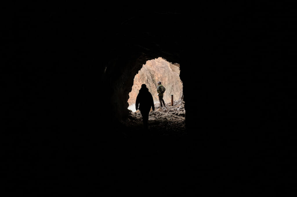
It was my second day hiking on the Michinoku Coastal Trail in Japan, and I had just scrambled down a steep descent to an isolated, rocky beach on the Kitayama coast in Tanohata, Iwate Prefecture. My guide, Norikatsu Watanabe, a ranger and planning officer with the Ministry of the Environment, had already recounted many harrowing events from the Great East Japan Earthquake and Tsunami. We had passed through the seaside town of Taro, where the 10-meter sea wall had been no match for the wave. We had visited the fishing village in Tsukuehama, where the fisherman’s banya huts had been swept away. Now I stood on this shore with Watanabe-san and my colleague Saeka. We faced the ocean as waves crashed hard against car-sized boulders. The beach was walled in by cliffs and accessible only by a man-made tunnel on one end, and a steep trail equipped with ropes and ladders on the other. This was where Watanabe-san would tell us his own story of March 11, 2011.

That day, at 2:46 p.m., a 9.1-magnitude earthquake struck in the Pacific Ocean, about 72 kilometers off the coast of Japan’s Tohoku region. The quake lasted for six minutes and was felt as far away as Beijing. The shock triggered a tsunami, with waves as high as 40 meters racing toward the coast at up to 800 km per hour. Within a half-hour, more than 1,000 km of coastline would be submerged. Entire communities were wiped away, and close to 20,000 people lost their lives.
On the afternoon the quake struck, Watanabe and several fishermen were leading a group of high school students on beach clean-up, in the very place I was standing with him now. The shaking dislodged rocks from the cliffs above, and the students huddled together near the shore to avoid being hit. The quake was terrifying enough, but they knew what was coming next. The group had hiked to the beach from the north, where the trail hugged the shoreline and passed through a series of man-made tunnels. That route seemed perilous and was now possibly blocked, so they made a quick decision: “Climb!” He urged the students up a steep, narrow path — the same one we had just descended — leading them to safety on the ridge above, just minutes before the tsunami hit.
As he tells it — tears welling in his eyes — this was only the beginning of the nightmare. With the power out, communication cut and roads obliterated, it took three frantic days for Watanabe to reach his family. They had survived, but the desperation of not knowing left a lasting impact on them all. Many of their neighbors were not so fortunate, and everyone lost people they knew and loved. For Watanabe, throwing himself into the recovery efforts–and eventually into his work on the Michinoku was a way to build something positive out of grief. It was the start of a process of reconnection, remembrance, and renewal.
The Michinoku Coastal Trail, and the Sanriku Fukko National Park through which it runs, were conceived as part of the Ministry of Environment’s “Green Reconstruction Project,” a series of initiatives aimed at community-led, sustainable reconstruction. The trail is a living monument to the victims, to the perseverance of the survivors, and to nature’s power — its ability to destroy and to heal. Stretching more than 1,000 km from Miyagi Prefecture to Aomori Prefecture, the Michinoku runs like a thread along the coast, stitching back together the communities torn asunder by the wave.
A three-day hike on the Michinoku Coastal Trail
Over three days in December 2021, I hiked with Watanabe-san and my colleague Saeka on several sections of the trail in Iwate and Aomori Prefectures. We encountered long stretches of easy terrain, followed by punishing climbs and tricky descents. We traversed white sand beaches and stood on rocky outcrops overlooking the churning waters below. I’ve done a good amount of trekking in this country, and the Michinoku may be the best hiking trail in Japan, as much for its beauty as for the story it tells. While the trail feels wild and remote, it never strays far from the communities whose cooperation and contributions brought it to life.
Day 1: Jodogahama, the Sakiyama Blowhole, and the Taro Sea Wall
We struck out from the Jodogahama Visitor Center in Miyako, Iwate Prefecture. There are six of these facilities along the Michinoku, offering practical services as well as opportunities to learn more about the local environment. We picked up some maps for our journey — an absolute necessity if you’re hiking any significant distance on the trail — and then hit the trail. This section starts out as a leisurely stroll along the area’s ria shoreline. We stopped at the Jodogahama Resthouse for the local specialty, bindon (in Japanese) — a choice of roe, salmon, or cod packed with seaweed into a milk bottle, then poured over rice with hot dashi broth. It felt like a hiker’s lunch, and we headed back out on the trail with warm, full bellies.


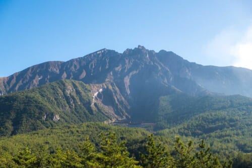
Making our way north, we passed through small villages, fishing harbors, and even a cemetery (during the earthquake and tsunami, residents evacuated to cemeteries and shrines — areas that had survived previous disasters). The terrain became more challenging as we climbed a ridge, but the effort was worth it. I breathed an audible gasp when I got my first expansive view of the coastline from above. In the distance, we saw a geyser of white water shooting into the sky–the Sakiyama Blowhole (in Japanese). When the waves are particularly powerful, as they were on this day, water is forced into an underground cavern and up through a small hole on the shore, reaching heights of up to 30 meters.
Toward the end of the hike, we reached the town of Taro, where in 2011 the sea wall (in Japanese) failed. 180 residents were killed and close to 2,000 homes were lost. Here the trail follows the rebuilt sea wall, and sections of the destroyed one are still visible, a reminder of the terrible power of the tsunami. Towns like this one faced difficult decisions after the tsunami — to stay or to go. Residents decided collectively how and where to rebuild to keep the communities together.
On our first night, we stayed at Hotel Ragaso in Tanohata. The hotel is operated by the village and is the area’s largest employer. Located on the shore, the Ragaso was flooded up to its third floor in the tsunami. In the months that followed, the hotel accommodated recovery workers, even as tourist demand eventually resumed. Now the hotel is back in business serving hikers and tourists. After a day on the trail, I felt pampered with a beautiful kaiseki spread featuring all local ingredients — seafood, beef hot pot, and tempura — followed by a hot soak and sauna at the public bath.
Day 2: Challenging Terrain from Tanohata to Kitayamazaki
We set out in the morning from Hotel Ragaso toward Tsukuehama, a collection of banya fishing huts that were rebuilt after the tsunami. We had booked a tour of the coast on a sappa fishing boat, but rough seas intervened. Instead, we visited a small salt-making facility and learned more about the economic revitalization efforts undertaken since the disaster. We ate lunch at L’aureole Tanohata (in Japanese), where chef Katsuyasu Ito worked his magic with fresh Tohoku ingredients, including mountain grape juice, grilled fish with shiitake sauce, and a smoked Maesawa beef shoulder roast.
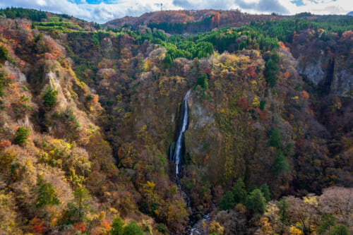
After lunch, we set out on some of Michinoku’s most difficult terrain. There are lots of up and down here, and if you’re looking for a challenging hike in Japan, this is a difficult but exciting section of the trail. We used ladders to descend to the shore where Watanabe-san had been on the day of the quake. I narrowly avoided getting swept off the rocks by a wave, before plunging into the darkness of a tunnel connecting us to the next cove. In some parts of the trail, the path is determined by the tide. In our case, we had to climb another ladder and take the high route toward Kitayamazaki. At dusk, from the observation deck atop the cliffs at Kitayamazaki, we looked back along the shore, taking in the full splendor of what is possibly the most beautiful hiking trail in Japan.

We spent the night in Hachinohe, a port city in Aomori Prefecture. This fishing town in Japan’s far northeast has a warm, welcoming vibe. The best way to experience Hachinohe is with a pub crawl through the Miroku Yokocho Yatai Mura, a street lined with food stalls serving up local delicacies and copious amounts of booze. Each stall seats just eight people, served usually by a single host, creating a cozy, sometimes raucous atmosphere. We sat shoulder-to-shoulder with locals as I tried basashi — raw horse meat — and Saeka bravely ordered the shirako–fish testes. The man sitting next to me assured me it was delicious, but I stuck with my horse meat and senbei-jiru, a local hot pot specialty. We ended the evening at Prince Bar, a friendly little hole in the wall serving specialty cocktails inspired by landmarks along the Michinoku. One of our hosts ordered the “Michinoku Shiokaze Trail”, a gin-based cocktail with blue curacao, grenadine, and a quail egg yolk. It looked just like sunrise on the trail.
Day 3: Hiking on the Tanesashi Coast
Our final day started with a 6 a.m. visit to a local wholesale market. The Mutsu Minato Morning Market is where local restaurants and shops stock up on fresh fish and vegetables, but several of the vendors also serve breakfast to locals and tourists — fish, rice, and steaming miso soup.
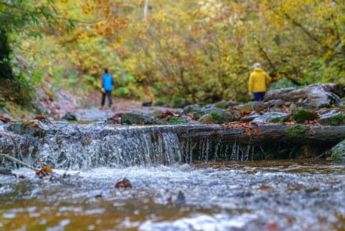
From the market, we headed back to the Tanesashi Coast, first crossing the Tanesashi Natural Lawn, a sprawling area of gently rolling, grass-covered hills. We progressed through pine groves and past rock formations before walking the long expanse of Shirahama Beach and the Osuka Coast, a 2.3-km stretch of singing sand. From the shore, we gently ascended to the Nakasuka promenade, a vast field that in the spring is filled with wildflowers.
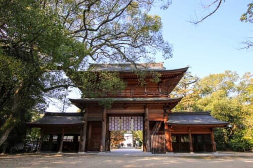
There was an energy in the air and a bounce in my step as we approached our destination. Kabushima Shrine sits perched upon a tiny islet at the northern Trail Head/End Point of the Michinoku. Climbing the steps of the shrine, I turned back for a moment to reflect on where we had come from. The Michinoku is a remarkable testament to this place and its people, who, from a great tragedy, got back on their feet and kept moving forward.
What’s the best time of year to hike the Michinoku?
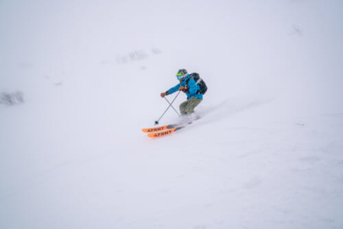
Any time between October and May. Hiking in Tohoku in the winter usually means lots of snow. This area, however, has milder winters with more sunny days than the mountainous inland areas, so the entire route remains open year-round. Winter, in fact, is an ideal time to hike the Michinoku for a few reasons. First, the pine trees lose their needles, creating a soft cushion on many parts of the trail. This also ensures unobstructed views of the ocean below. Insects are scarce during the winter, and the black bears are hibernating.
What do you need for hiking in Japan?
All the basics like water, snacks, a good pair of boots. The weather can change quickly along the coast, so bring rain gear, plenty of layers, and some towels. Headlamps are recommended for the tunnel passages. Cell reception is non-existent in some areas, so always let someone know your route and schedule. Finally, and this is important, don’t attempt any section of this trail without a map. You can download maps and detailed descriptions of each trail section from the Tohoku Regional Environment Office website, or purchase physical copies at any of the six visitor centers along the trail.
Where are the best places to stay when hiking the Michinoku?
You’ll want to have your lodging arranged and booked in advance. In addition to hotels like the Hotel Ragaso in Tanohata, or The Park Hotel Jodogahama, there are also guesthouses like the Minshuku Michiai in Fudai, offering a more personalized touch.
What is there to do in Tohoku?
There’s plenty more than just hiking along the Sanriku Coast. Around Hachinohe, for example, on the Tanesashi section, there’s camping, standup paddleboarding (SUP), and sea kayaking. Sappa boat tours, like those offered in Tsukuehama, are a good way to see your route from a different vantage, and to get up close to some of the unique geological features of the coast. The staff at visitor centers can suggest or help arrange outings and activities near the Michinoku.
How do you access the Michinoku trail?
Kabushima Island, in Aomori Prefecture, marks the northern trailhead. Matsukawaura, in Fukushima, is the southern entrance to the trail. There are numerous access points along the trail, most of which can be accessed by public transportation. The Shinkansen bullet train will get you from Tokyo to major cities like Sendai and Hachinohe within just a few hours. Local Japan Rail trains, run along much of the route, and you can often walk or take a bus from points along the trail to the nearest train station. The Sanriku Railway is another scenic train option that follows Iwate’s coastline between Sakari Station and Kuji.
The Michinoku Coastal Trail in Tohoku is one of the best hiking trails in Japan. Stretching from Fukushima prefecture, through Miyagi, Iwate, and Aomori, the trail offers an adventurous nature walk through the Sanriku Fukko National Park. With its natural beauty and close connection to local residents, hiking the Michinoku is one of the most fun things to do in Tohoku.
Sponsored by the Ministry of Environment Japan


No Comments yet!